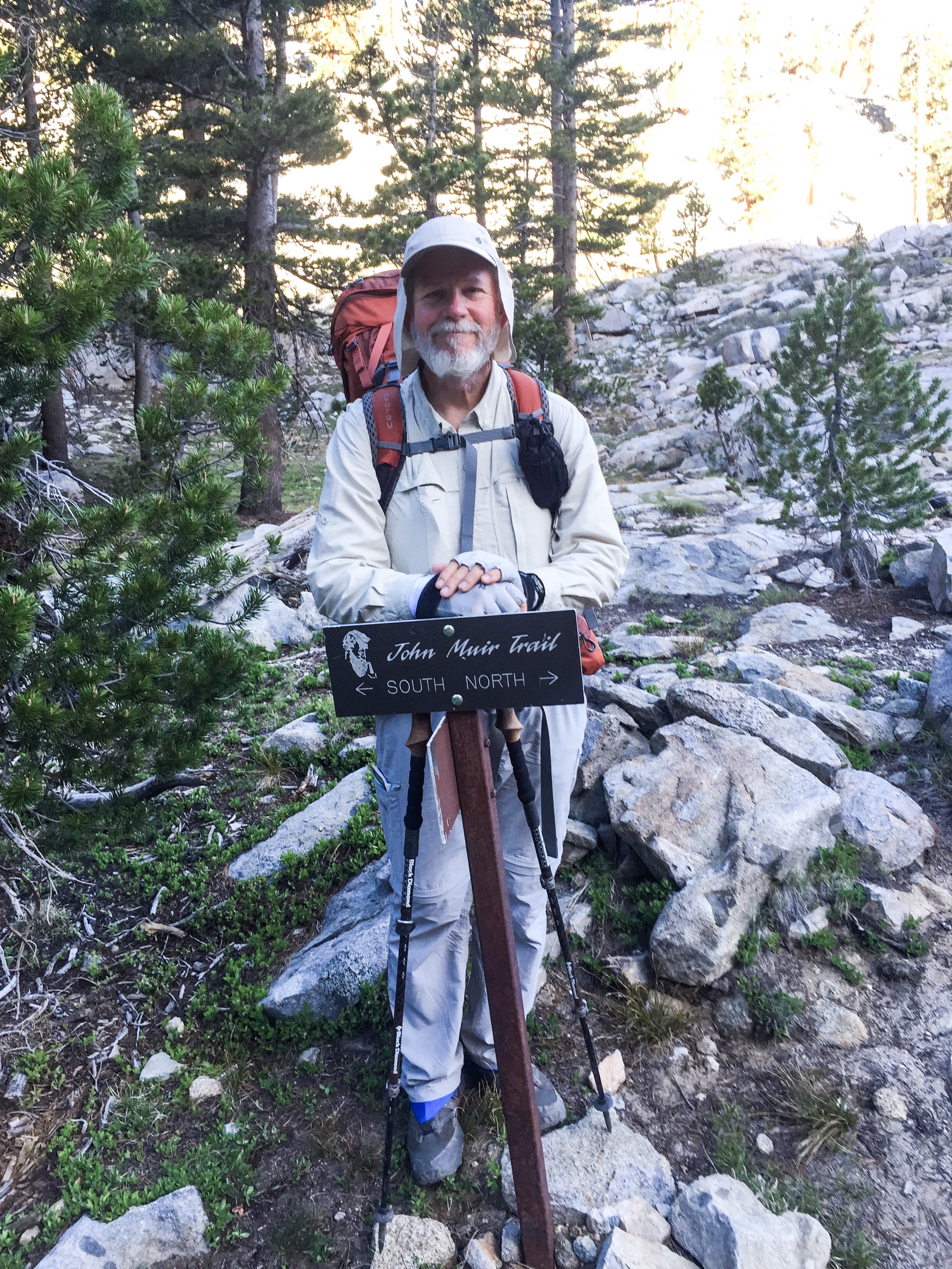
This section, at 95 miles is the largest section with no cell service so far. There are six major passes (10,900+ft) in that 95mi to make things interesting.
What are Passes? The mountains are separated into “Watersheds” where Snow and Rain flow into the same Streams/Rivers. The “Passes” are the low spots between Watersheds.
Friday, June 19th ——
The ride back to the Trail Head was…interesting. We were at the intersection for Onion Valley at 6am. There were no cars at all for 2 hours. We were discouraged and finally called a number on the gas station’s wall for a ride. The guy said the cost was $20/each (Ouch) and he’d be there in 10 mins.
A dirty, old Toyota Tacoma pulled up with two large Lab dogs in the bed. The driver was a short 20-something guy named Levi who looked like he hadn’t made it home from the bar yet. As we piled in we climbed over the beer cans and bottles. The full cans and bottles…there were no empties. There had been seat covers, but they were Sun rotted. As was the steering wheel cover. We didn’t care as we just needed a ride up the 13 miles to the trail.
He turned out to be a rather nice guy who chatted about his favorite beers (Free & Cold), his “Baby’s Mama” complaining too much and his love of hunting rabbits and coyotes.
Thankfully we finally made the trail and Levi returned to the Red Neck Life.
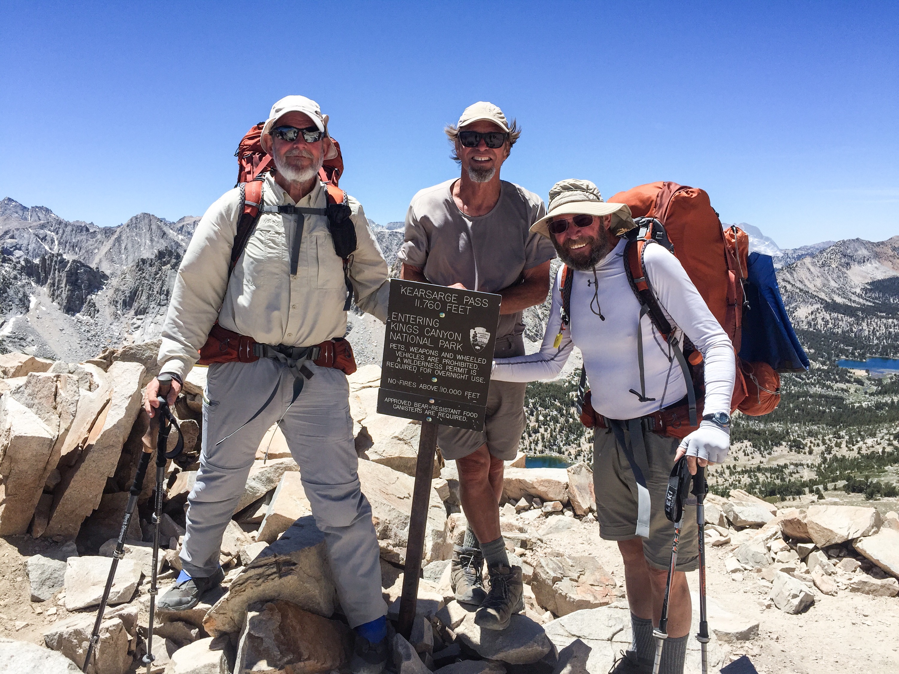
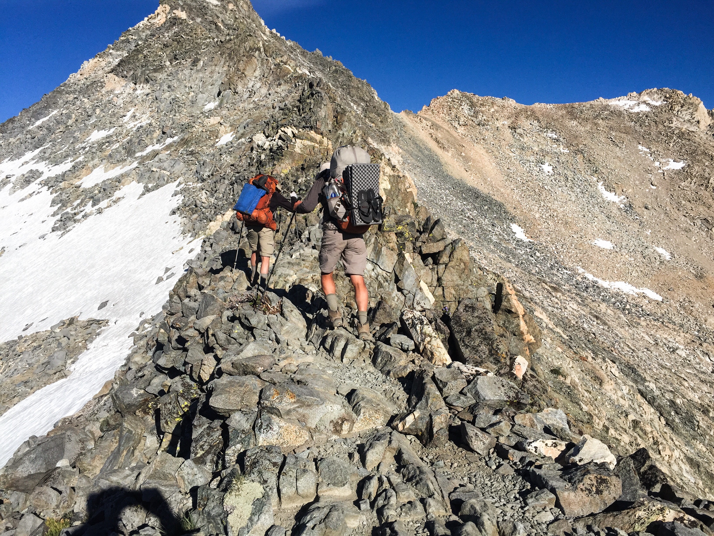
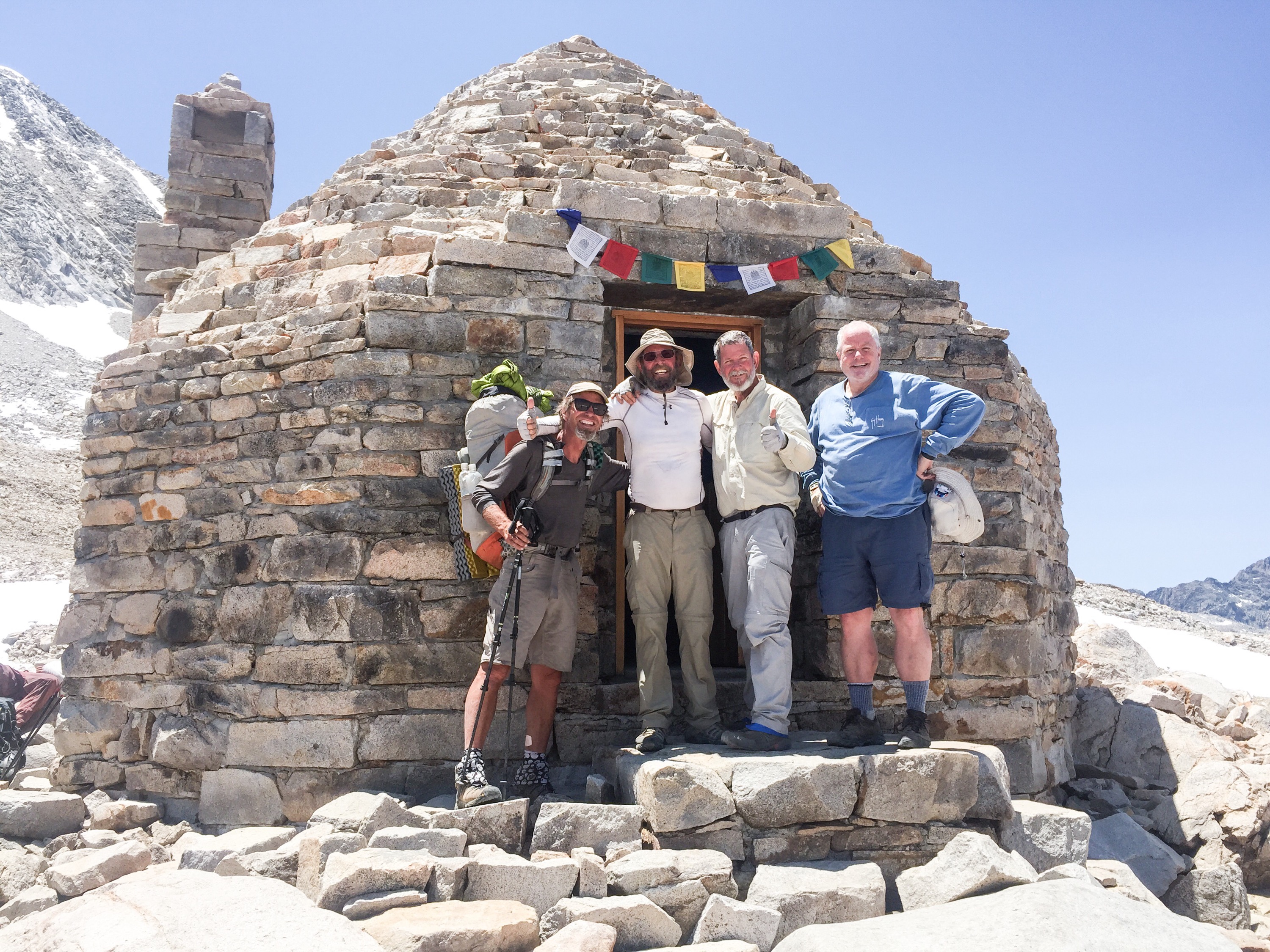
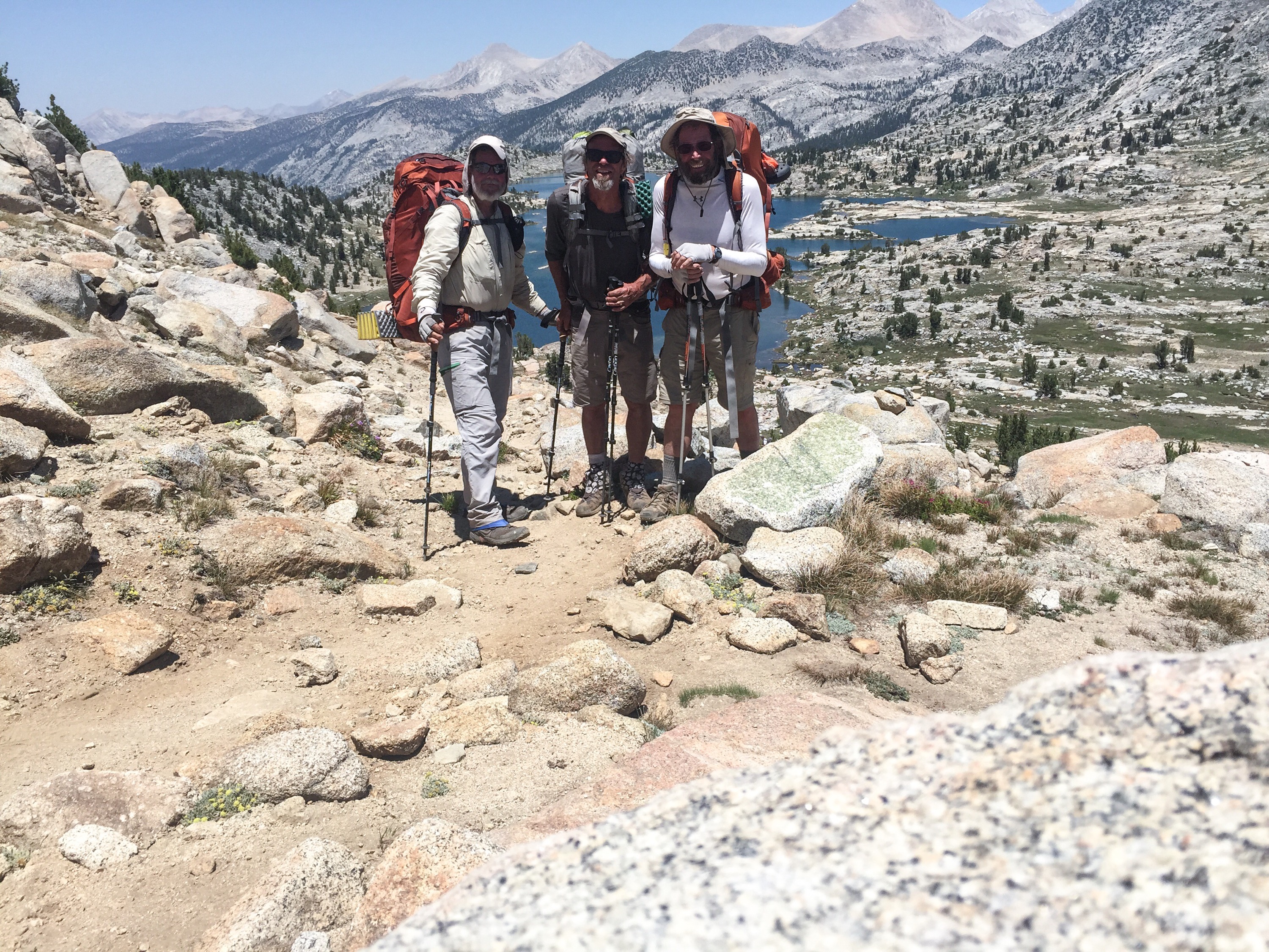
We felt strong coming on trail after 1.5 days rest, so we hiked both Kearsarge (11,900 ft) and Glen (11,980 ft) Passes on the same day. Turned out to be Not A Wise Decision as Glen was far more difficult than we anticipated. We dragged into Rae Lakes at 7:30pm and didn’t eat dinner till almost 9pm with headlamps.
This was a shame as Rae Lakes are a chain of lakes feeding into each other and are really, really nice. Didn’t get to see much. 😞
Below is the three of us on Kearsarge and the two on the edge of Glen Pass.
 Saturday——–
We were still weary from the hike over Glen Pass, so we just did 9 miles to the base of Pinchot Pass. This was really pretty country hiking down the Woods Creek watershed. AND we passed the 800-Mile point!!!
My decision to start in Mid-April was the correct one for the Sierras this year. With almost no snow left on the slopes, the rivers and creeks are near Mid-July levels. In another month many of the creeks will be dry.
 Sunday, June 21st ———-
This is a Special Day!
- Summer Solstice
- Father’s Day
- Hike naked day
We made the top of Pinchot Pass (12,130ft) and the wind nearly blew us back to the other side! The chilly wind dogged us all day with gusts to 40mph. This may have affected participation in Hike Naked day…I just saw one brave young couple hiking with nothing but shoes. I asked the young lady how she was handling the wind: she replied it was fine while hiking but too cold when she stops. 😏 Lucklly the older folk, like myself stayed clothed. 😎
There were many stream crossings which slowed us up. We did 12 miles to the base of Mather Pass, (12,100ft) but it was too late to summit.
The next pass is Muir (11,955ft) and the distance, elevation loss and gain make this one tough:
- 23.3 miles from where I am now
- -4,500 (elevation loss)
- 5,000 (elevation gain)


Monday ——–
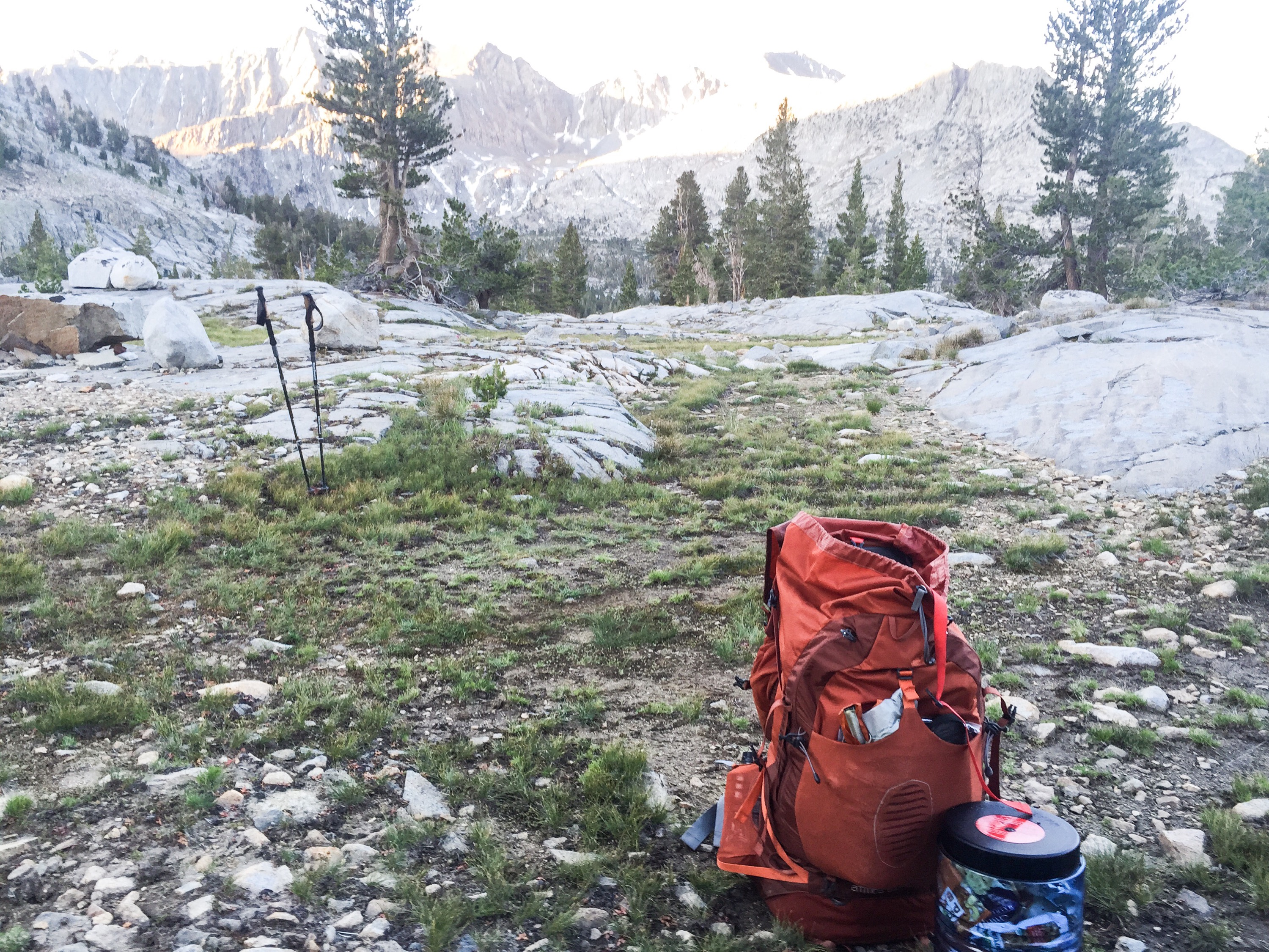
We rose at 4:30am to try and make as much distance as possible. There were no clouds and the temps were just below freezing as we began our ascent of Mather Pass. The trail was the nicest of the passes so far and we summited with no problems.
The descent toward North Fork Kings River began at the crossing of the pass. It was a long, difficult day dropping 4,500ft in 10 miles. We went down through the fabled “Golden Staircase”, with are steep switchbacks for 3 miles. I further bruised my left foot there. 😣
We made it another 3 miles past the low point for a 15 mile day. This leaves “just” 8 miles of all up hill to Muir Pass tomorrow. We also might finally catch up the Mother Goose, Fire Ant and Marilyn.
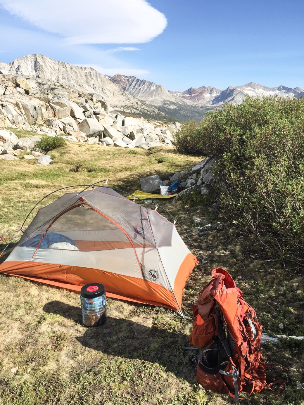
Right now I’m camped beside the middle-fork of the Kings River, and the roar of the cascades is quite noisy, but nice and lulled me to sleep.
 Tuesday ——–
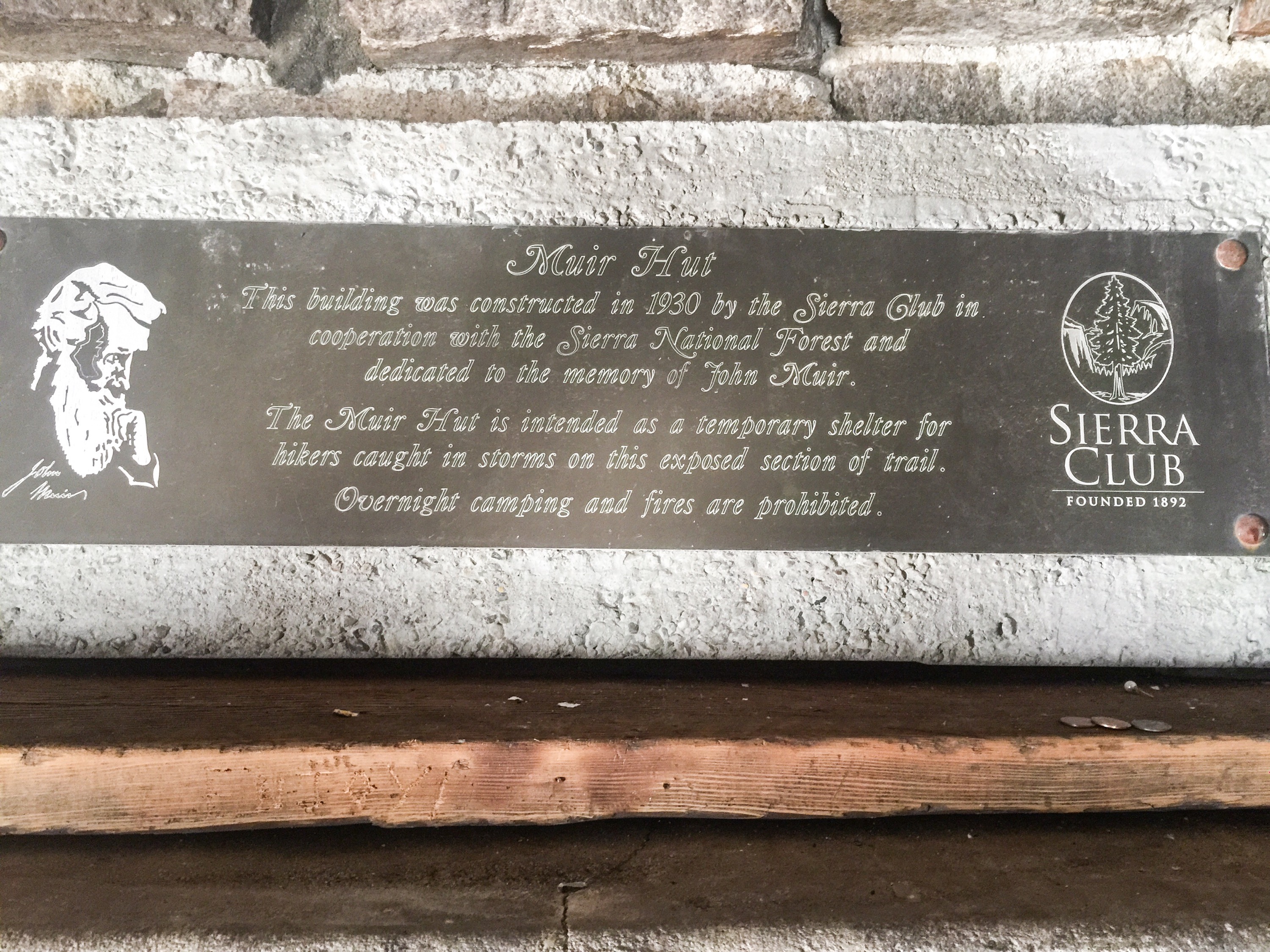
The 8 mile climb to Muir Pass was steady but the rewards were amazing. Chains of high mountain meadows finally give way to crystal clear alpine lakes. At the top is a “Hut” built of stone and called Muir Hut. Even the roof is stone. Very impressive.
What was even more impressive was the group of people who showed up as we were leaving. The founder of the company “Revisit” (sp ??) paid a Cellist and Violinist to play tonight while being filmed for some kind of publicity thing.
We didn’t stay, but hiked another 5 miles to Evolution Lake. Another amazing lake.
It’s after 11pm, I’m laying in my tent watching the stars, listening to the distant falls and the few frogs and can’t sleep. 😞 …and listening to hikers going by! That 5 miles from the pass takes 2-3 hours to hike, and these are the people who must have stayed for the “Concert”. There were no campsites at the pass, and the ones we are in were some of the first. I’ve had my tent lit up by passing hikers looking for a spot. At least it’s a nice night to hike. <laughs>
Then later a group of eight go by and I recognized them as the musicians, photographers and others we met earlier. What an active night! <groan>
 Wednesday——–
Our goal today is Muir Trail Ranch. (MTR). This is a really remote Dude Ranch that caters to people wanting the western experience. It is also just 1.5 miles from the PCT and allows people to mail a resupply bucket for the fee of $65 plus postage. (No boxes…it must be a 5-gal bucket.)
The professor has a bucket waiting, so we made MTR our goal today. So we followed the Evolution Creek which flowed into the south fork of the San Joaquin River for 13 miles and the ford across was tough; the river is wide and strong. Then another 1.5 miles to MTR where he picked up his bucket.
There was another reason we came here: Hot Springs! Once we chose a our campsite, we forded the river again and walked 0.1 mile to one of the dug out pools. It was very nice to soak the day’s aches away. We were naked since who carries bathing suits 850 miles? 😜
After a while, four ladies joined us and we has some nice conversations. And, yes: three of them were naked as well. It was a nice way to end the day. No pictures. (You naughty people)
Thursday——–
We bid farewell to MTR and started the long, 3,000ft climb to Selden Pass. (10,900ft) it was a fairly nice climb past high meadows and lakes. Once over the Pass we were greeted with the sight of Marie Lake, named after one of John Muir’s daughters. After fording Bear Creek we finally settled bedsides Bear Creek for the night. Tomorrow we get to Edison Lake and Vermillion Valley Resort. (VVR) We can buy food, burgers and it has Cell Service!!!
Friday——–
VVR was, indeed wonderful. It is a rustic little store/restaurant that really caters to hikers with showers, laundry and an overall welcoming atmosphere. After seven days on the trail I was ready for real food! And that little restaurant, while pricy, had excellent food.
It, however did not have cell service! The far end of the lake close to the trail does, but the topography is the area is rugged. So I will send this as we hit the trail for Silver Pass, on the way to Mammoth Lakes; a three day trip.
I should be back on-line Monday.
-HalfFast

Your pictures are just beautiful, I hope you are enjoying that part of it as much as I am enjoying seeing your pictures! I know it’s 1 million times better in person. It was good to hear from you is see that you’re doing well, I hope your foot can catch a break. 800 miles is amazing! Thanks for sharing!
LikeLiked by 1 person